
From Ice to Valley: The Making of Wilbraham and Hampden’s Landscape
- Sep 3, 2025
- 3 min read
Updated: Dec 10, 2025
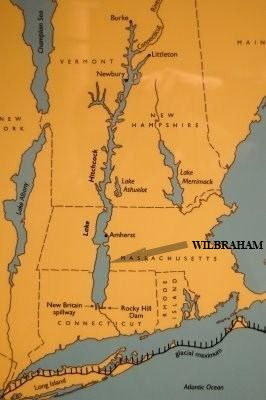
The towns of Wilbraham and Hampden, along with other communities in the Connecticut River Valley, were once partially covered by a vast body of water called Lake Hitchcock. This glacial lake formed about 15,000 years ago after the Laurentide Ice Sheet began to melt. The ice melt collected at a natural dam near Rocky Hill, Connecticut, blocking the Connecticut River and creating a long, narrow lake that stretched north about 200 miles to St. Johnsbury, Vermont. Lake Hitchcock lasted for roughly 3,000 years before draining away through erosion and shifting land. It is named after Edward Hitchcock (1793–1864), a professor of geology at Amherst College who studied it.
Long before Lake Hitchcock formed, the region went through several ice ages. About one million years ago, Earth’s climate cooled, and glaciers began to spread across large parts of the world. In New England, the most important of these was the Wisconsin Glaciation, also called the Wisconsin glacial episode, which was the most recent glacial period of the North American ice sheet complex, which began about 70,000 years ago. Snow and ice built up faster than it could melt, burying the land beneath more than a mile of ice in places, nearly two miles thick in Labrador and eastern Canada. The ice crept across Massachusetts, grinding down softer rocks like the Longmeadow sandstone more quickly than the harder rocks of the Wilbraham Mountains. This left the mountains standing out in sharper relief. On exposed mountaintops in Wilbraham and Hampden today, you can still see grooves, scratches, and even polished surfaces where rocks were dragged across the land by the glacier.
The ice reached its greatest extent around 35,000 years ago. After that, it slowly began to retreat, reaching the Wilbraham and Hampden area about 12,000 to 15,000 years ago. By around 9,000 years ago, the region was finally free of ice. As the glacier melted, its waters flooded valleys and lowlands. For hundreds of years, the entire Connecticut River Valley was underwater. From Holyoke southward, this great body of water is sometimes called Glacial Lake Springfield. In Wilbraham, the lake once stretched from Main Street westward to the foothills of the Berkshires.
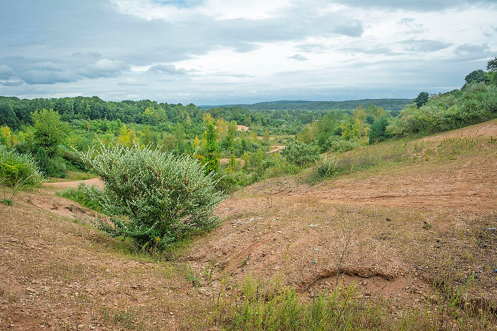
The Chicopee River system carried much of the meltwater into the lake, depositing enormous amounts of sand, silt, clay, and gravel. The coarser material settled quickly, building a wide delta that extended for miles into the lake from Wilbraham and Ludlow. Finer sediments drifted farther before settling. The low-lying areas west of the Wilbraham Mountains, including Cedar Swamp, are remnants of this delta. The flat terrain stretching from western Wilbraham into Springfield’s Sixteen Acres neighborhood is also part of it. In contrast, the rounded hills scattered through town are glacial till, rock, and soil left behind under the moving ice. Some of these hills stuck up above the lake waters, and you can still find traces of ancient lake shorelines carved into their slopes.
Over time, Lake Hitchcock drained away. As the heavy ice sheets melted, the land itself slowly rose back up (a process called isostatic rebound), allowing streams and rivers to take on their present-day courses. The retreating ice also left behind large buried chunks that eventually melted, creating kettle-hole ponds such as the small pond located behind the Academy’s Blake Middle School building, and Brewer’s Pond in Wilbraham.

Since then, the landscape has remained much the same. The rocky soils of the Wilbraham Mountains developed from glacial till, while the sandy and marshy soils in the lowlands came from old lake sediments. Except for gradual changes caused by rivers deepening their valleys, the basic features of Wilbraham and Hamden’s landscape today were shaped by those powerful forces of ice, water, and time.


Comments